Why In News?
Recent flash floods triggered by extreme rainfall in the Himalayan States have brought the severe disaster risks of cloudbursts into sharp national focus.
What is a Cloudburst?
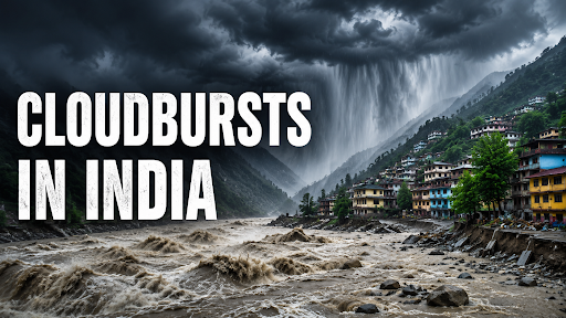
A cloudburst is an extreme, highly localized rainfall event occurring over a very small area within a short period.
The India Meteorological Department (IMD) defines a cloudburst as 100 mm or more rainfall in one hour over an area of approximately 20–30 sq. km.
-
Such intense rainfall often triggers flash floods and landslides, especially in mountainous regions.
Mini-Cloudburst: Although not officially recognized by IMD, several meteorological studies classify 50–100 mm rainfall in one hour over a similar area as a mini-cloudburst, as it can also cause severe damage in fragile Himalayan terrain.
Where are Cloudbursts Most Common in India?
Himalayan Region: The highest frequency of cloudbursts occurs along the southern Himalayas, particularly in Uttarakhand, Himachal Pradesh, Jammu & Kashmir, and Ladakh, where steep mountain slopes rapidly lift moisture-laden monsoon winds.
Western Ghats: The windward side of the Western Ghats, stretching from Goa to Gujarat (Saurashtra), is highly vulnerable as moisture-rich Arabian Sea winds undergo sudden orographic lifting, producing localized torrential rainfall.
North-Eastern Hills: Arunachal Pradesh, Sikkim, Meghalaya, and other northeastern hill states frequently experience cloudbursts because rugged terrain and deep valleys intensify convective activity and channel moist winds upward.

Why Do Cloudbursts Occur?
Orographic Effect: When warm, moisture-laden monsoon winds strike steep mountain ranges such as the Himalayas or Western Ghats, they are forced to rise rapidly.
-
The rising air cools quickly, causing intense condensation and extremely heavy rainfall over a very small area.
Valley Funnelling: Narrow mountain valleys act like funnels, concentrating moist air into confined spaces and strengthening upward motion.
-
This localized lifting often triggers cloudbursts, as observed in regions such as Kullu (Himachal Pradesh) and Garhwal (Uttarakhand).
Deep Convective Clouds: Strong surface heating creates towering Cumulonimbus clouds reaching 12–15 km in height.
-
Powerful updrafts suspend large water droplets until they collapse, releasing enormous volumes of rain within minutes.
High Atmospheric Moisture: The interaction of the southwest monsoon with Western Disturbances or other upper-air systems increases atmospheric moisture, creating ideal conditions for explosive rainfall.
Strong Atmospheric Instability: High Convective Available Potential Energy (CAPE), abundant precipitable water, vertical wind shear, and slow-moving thunderstorms allow rain-bearing clouds to remain stationary over one location, leading to cloudbursts.

Why are Cloudbursts a Major Disaster Management Concern?
Flash Floods: Sudden release of massive water volumes overwhelms drainage, triggering destructive flash floods that wash away settlements, roads, and bridges.
Landslides and Debris Flows: Intense rainfall rapidly saturates mountain slopes, causing rockfalls, landslides, and debris flows, as demonstrated by the 2025 Dharali (Uttarakhand) and Kishtwar (J&K) disasters.
Infrastructure Damage: They destroy highways, bridges, power lines, and projects, with Himachal Pradesh reporting about ₹1,952 crore in losses during the 2025 monsoon.
Loss of Life and Livelihoods: Sudden onset leaves minimal evacuation time, causing displacement, casualties, and severe long-term livelihood losses in mountain communities.
Disruption of Essential Services: Cloudbursts damage roads, drinking water, and electricity supply, isolating remote villages and delaying critical rescue operations.

What are the Major Challenges?
Highly Localised Nature: Cloudbursts occur over only 20–30 sq. km, much smaller than the grid resolution of most operational weather models, making precise location forecasts extremely difficult.
Limited Forecasting Window: Unlike cyclones, cloudbursts develop within minutes from rapidly growing convective clouds, leaving forecasters with very limited lead time.
Sparse Weather Radar Coverage: Mountain ranges obstruct Doppler Weather Radar (DWR) beams and many Himalayan regions still lack adequate Automatic Weather Stations (AWS), reducing real-time monitoring capability.
Rapid Urbanisation in Hazard-Prone Areas: Encroachment on riverbeds, hill cutting, deforestation, and unplanned construction reduce natural drainage, greatly increasing flood and landslide impacts during cloudbursts.
Weak Last-Mile Warning Dissemination: Poor mobile connectivity and communication infrastructure in remote Himalayan valleys often prevent timely delivery of early warnings to vulnerable communities.
Difficult Rescue Operations: Steep terrain, damaged roads, and adverse weather frequently delay search-and-rescue teams, evacuation, and relief distribution in affected mountain regions.
What Measures Can Reduce Cloudburst Risks?
Expand Doppler Weather Radar Coverage: Install more radars in the Himalayas to remove blind spots. India is doing this through Mission Mausam, which aims to double the current radar network from 40 to over 80.
Improve High-Resolution Weather Forecasting: Utilise Artificial Intelligence (AI) and massive supercomputers to predict hyper-local weather events down to the panchayat level.
Strengthen Flash Flood Early Warning Systems: Implement tools like the South Asian Flash Flood Guidance System (FFGS), which helps generate warnings 6-12 hours in advance at the watershed level.
Restrict Construction in Hazard-Prone Zones: Strictly enforce zoning laws. Ban hotels and roads on fragile riverbeds and steep slopes to allow water to drain naturally.
Promote Climate-Resilient Infrastructure: Build "green infrastructure," underground drainage in hill towns, and flood-resistant bridges. E.g., Himachal Pradesh proposed new green infrastructure norms after the 2023 disasters.
Build Community-Based Disaster Preparedness: Train local villagers and pilgrims in evacuation protocols. E.g., The Uttarakhand SDRF conducts annual mock drills for the Char Dham Yatra,.
Conclusion
To combat the growing incident cloudbursts, India must urgently bridge the gap between advanced meteorological forecasting and strict, climate-resilient urban planning at the grassroots level.
Source: THEHINDU
|
PRACTICE QUESTION Q. Consider the following statements regarding 'Cloudbursts' in India: 1. The India Meteorological Department (IMD) defines a cloudburst strictly as rainfall of 50 mm or more in an hour over an area of 20-30 square kilometres. 2. The phenomenon of orographic lifting in the Himalayas is a major geographical driver for the formation of cloudbursts. 3. Doppler Weather Radars face functional limitations in tracking cloudbursts in mountainous terrains due to topographical blind spots. Which of the statements given above is/are correct? A) 1 and 2 only B) 2 and 3 only C) 1 and 3 only D) 1, 2, and 3 Answer: B Explanation: Statement 1 is incorrect: The India Meteorological Department (IMD) defines a cloudburst as an intense, localized precipitation event where 100 mm (10 cm) or more of rainfall occurs in a single hour over a small geographical area of roughly 20–30 square kilometers. The statement's claim of 50 mm is structurally inaccurate. Statement 2 is correct: The primary driver of cloudbursts in northern India is orographic lifting. When warm, moisture-laden monsoon winds traveling from the plains hit the steep mountain barriers of the Himalayas, they are forced to rise rapidly. This rapid vertical ascent cools and condenses the moisture, forming massive, unstable cumulonimbus clouds that unleash sudden torrents. Statement 3 is correct: Even though Doppler Weather Radars (DWRs) are excellent at tracking severe weather, they face severe functional limitations in mountainous terrains due to "beam blocking." The complex topography and jagged mountain peaks create major blind spots by reflecting or blocking the radar signals, which restricts the radar's ability to accurately detect low-level cloud dynamics or predict localized cloudbursts in narrow valley systems. |